
One of my closest college friends Lindsay is moving away to go to a pre-med program in DC at the end of the month. Lindsay lives with Amy and Chris and so, as a kind of reverse going away present, she decided to paint them a mural.
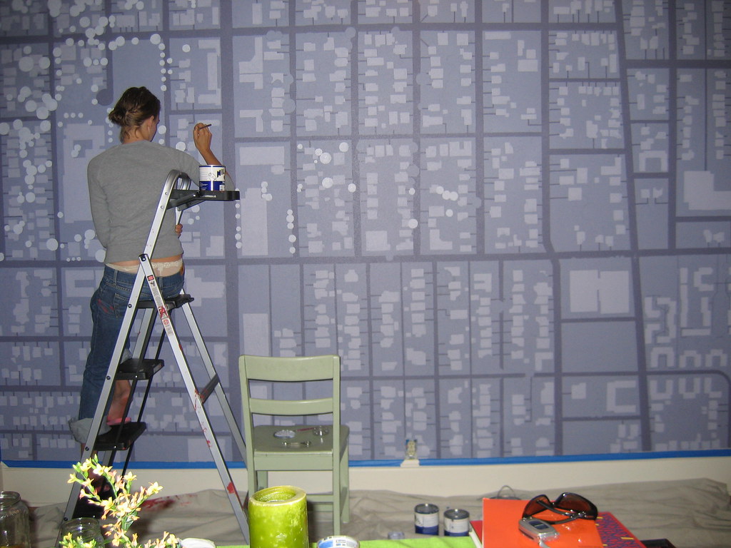
Since Amy’d just bought their house, Lindsay came up with this great idea for a mural. First, she downloaded an aerial picture of the area from TerraServer (almost everyone I’ve seen talk to her about it has given her a hard time for not using Google Maps, but she says TerraServer’s picture was better).
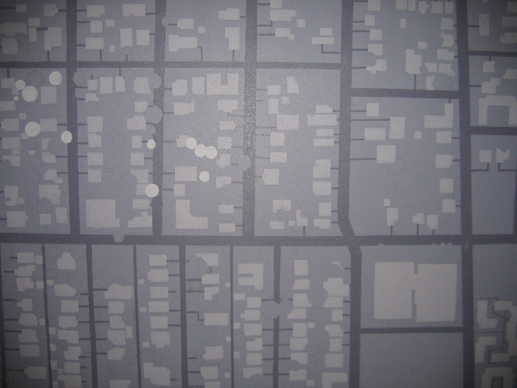
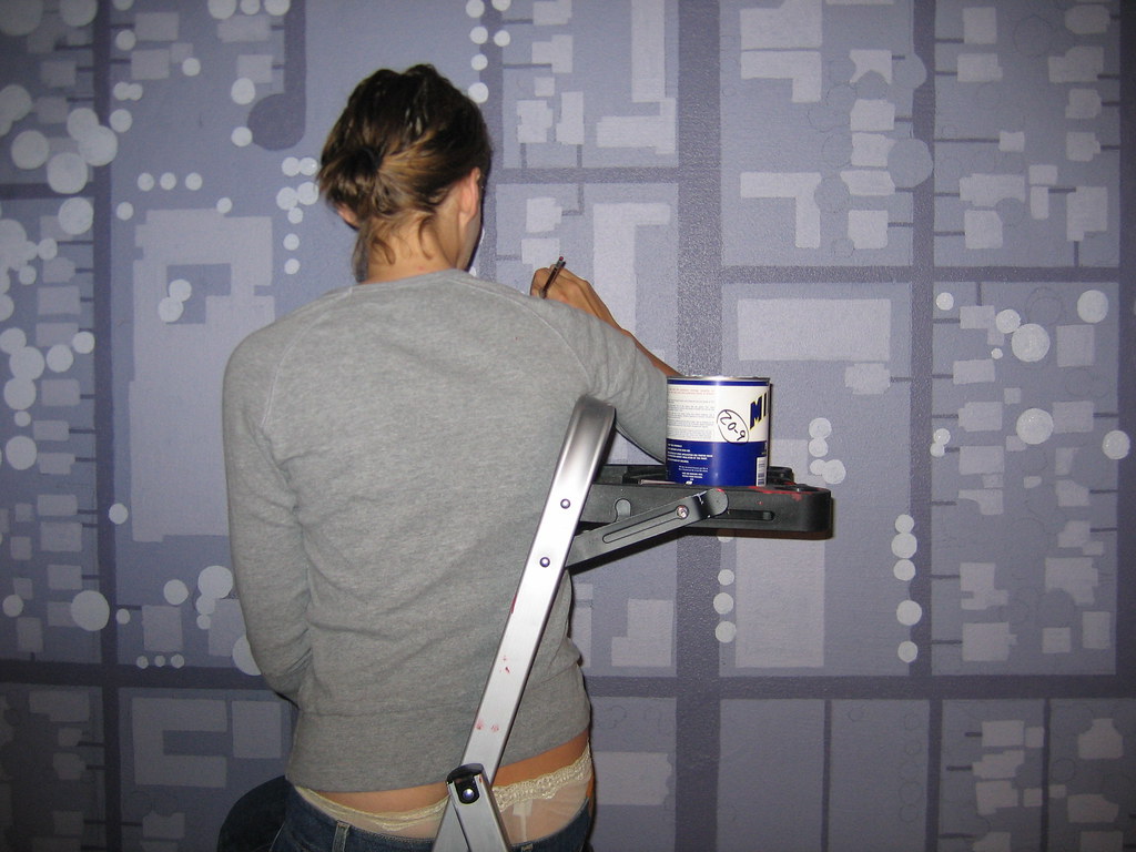
Then she spent a week hand tracing the picture with simple geometric shapes in Photoshop: rectilear forms for the buildings, circles for the trees, etc. Next, she got slides made from her Photoshop files, borrowed my slide projector, and projected the image onto the wall so we could trace it. I helped her trace the whole thing in pencil. It took four slides to cover the whole wall and getting them line up was a challenge, as was keeping the projector parallel to the ground and still on the rickety ladder we had setup. Once the map was traced onto the wall, Lindsay taped off the streets and we started painting. When I last saw it (Cary and I helped paint some trees night before last), it was nearing completion. All that she had left was to hand erase all the pencil lines and paint in the house itself. She’s going to use a nice contrasting orange for that
One of the interesting decisions Lindsay made was how to orient the map on the wall. Instead of doing it with North facing up, she up South at the top. At first this is highly disorienting because of how accustomed we are to looking at maps North-up. But then, once you realize that up on the map is the direction you’re facing, everything seems to fall into place.
I’ll try and get a picture of the whole thing in a finished state next time I’m over there so I can put it on my Flickr account for all to see. This is such a great project. Lindsay has definitely left her mark on that house in a lasting way.
Technorati Tags: satellite, map, mural, north, portland, painting, TerraServer, Lindsay Fuchs
I’ve been thinking for a while about installing a projector on the opposite wall, hooked up to the google maps API. I’ll set it up so that when you enter an address, it is spotlighted on the wall map. We can get directions to places, put up photos of our neighbors, etc.
But first I need a digital projector.
I’ve recently completed a set of ceramic tiles based of of terraserver imagery of highway interchanges.
http://www.designboom.com/contest/view.php?contest_pk=2&item_pk=526&p=1
Thanks for blogging her work- it is always refreshing to see another person use the same starting point but come up with a completely different idea from the same raw data.
Is Lindsay going to be mad that you posted her unmentionables on flickr in extra large format for all to see? (This site is one of today’s most popular on del.icio.us today, by the way – congrats!)
Nice work Lindsay. Great idea.
someone that creative must be just as beautiful.
lindsay is indeed mad at greg for the posting of her unmentionables on this blog, flickr AND boing-boing for all to see. thanks a lot, you punk.
but I love you anyway– can’t wait to see you in a few weeks!
hi
I blogged your article which threw up some interest an idea that I might have relativly
I went out with Lindsay in high school once. So I feel partial credit for this is due to me.